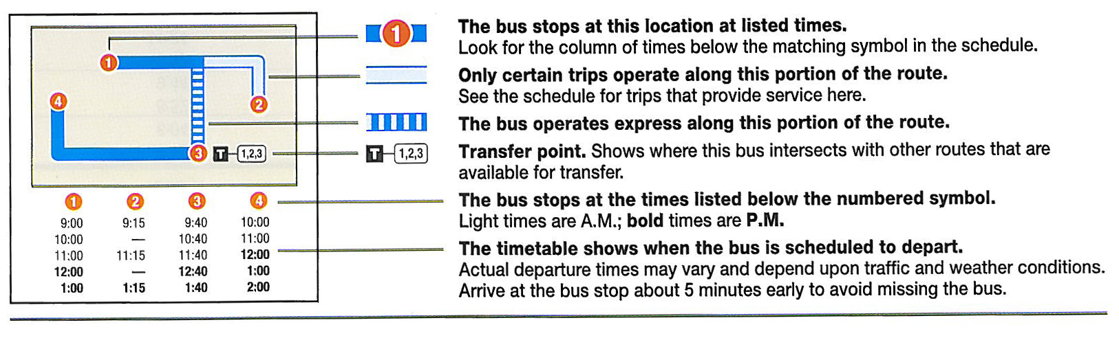
Reading Route Schedules
(See also: Route maps and schedules)
System And Downtown Map Instructions
(See also: System Map)
The system map is a large map that represents the major streets and areas served by MATA. For ease of reference, all routes are color coded on the map and the frequency chart. The accompanying frequency chart outlines the frequency of service for individual routes by day of the week and part of day. The system map is printed bi-annually and available upon request at all three MATA transit centers or by mail. Service information is subject to change. Please see individual route schedules for exact service times.
The map of Downtown Memphis also features color coded routes that correspond with the system map and frequency chart. It highlights connected trolley lines, major streets, and points of interest. (See also: Downtown Memphis Map)
Trolley Map Instructions
(See also: Trolley Map)
The Trolley map represents the three lines, major streets and trolley stops, transfer points, and points of interest. Each line is color coded to correspond with a legend for service hours, frequency, and travel directions.